Meteorologists are warning that the Northeastern United States is on track to experience a blast of extreme Arctic air in the days leading up to Christmas, with some forecasts suggesting the region could face what they describe as among the coldest conditions anywhere on Earth during the same period. The incoming air mass, driven by a sharp southward dip in the polar jet stream, is expected to push temperatures far below seasonal averages from the Upper Midwest to the Atlantic seaboard.
Forecast models indicate that temperatures in major cities including New York, Boston and Philadelphia could plunge 15 to 25 degrees below typical December levels. Overnight lows may fall into the teens or single digits Fahrenheit, while interior parts of New England and upstate New York could see sub-zero readings. Several forecasters have characterised the pattern as unusually severe for early winter, noting that the intensity of the cold rivals conditions normally seen in the deepest part of the season.
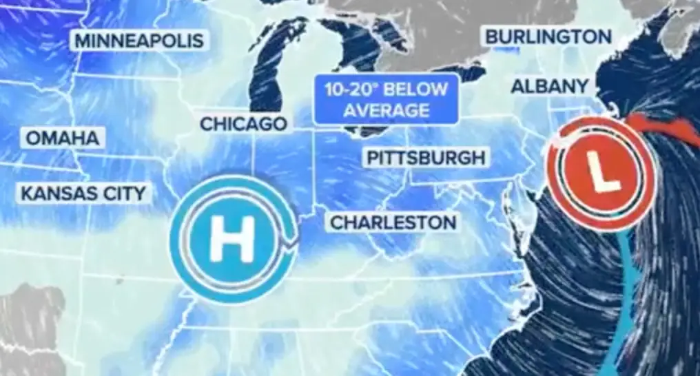
The cold blast is tied to a large pool of Arctic air descending from northern Canada, pushed south by a disruption in the polar vortex. When this occurs, the boundary between polar and mid-latitude air weakens, allowing frigid air to spill southward and settle over the central and eastern United States. Meteorologists say the upcoming pattern is one of the strongest such events of the season and warn that, with the right storm track, it could coincide with significant snowfall.
Before the extreme cold arrives, a winter storm is expected to move across the Midwest and into the Northeast. Forecasters believe this system could deliver widespread snow along with pockets of sleet and freezing rain, raising concerns over hazardous travel conditions. In some areas, snow accumulation may be substantial enough to disrupt road and air travel just as holiday-season movement begins to intensify.
The combination of heavy snow and severe cold poses risks to infrastructure as well as public safety. Power utilities across the Northeast are preparing for the potential strain on electrical grids as heating demand rises sharply. Emergency-management officials have urged residents to prepare for the possibility of power outages, frozen pipes and dangerously low wind-chill values. Exposure to wind chills well below zero can lead to frostbite within minutes, particularly for vulnerable populations.
This early-season cold comes after several recent weather systems have already delivered snow to parts of the Great Lakes and interior Northeast. Long-range forecasters have cautioned that the winter ahead may see repeated Arctic intrusions, influenced by large-scale climate patterns that favour colder conditions in the eastern half of the country. The approaching cold snap, they say, may be the first major indication of a harsher-than-normal winter.
As the holiday period approaches, transportation authorities are monitoring the developing conditions closely. Any combination of heavy snow, rapid temperature drops and high winds could lead to flight cancellations, road closures and delays across major transport hubs. Officials advise travellers to stay alert to changing forecasts and be prepared for disruptions.
With Arctic air gathering strength and storm activity increasing, the Northeast is bracing for what could become one of the most severe early-winter cold spells in recent memory. Forecasters say conditions may begin easing after Christmas, but warn that additional outbreaks of intense cold remain possible through the rest of the season.